
July 2, 2016
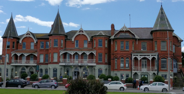
It’s just after 2:00 pm and I am walking along the seaside esplanade in Bray. To my right are hotels and restaurants, like this one:
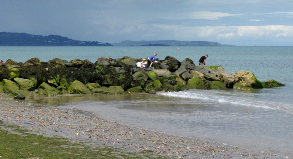
To my left is a thigh-high wall separating the esplanade from the ocean. The beach here is covered in small stones, but that doesn’t stop families, children, and couples from running or walking up and down the bay. A seaweed-encrusted break wall, in particular, is too tempting to resist.
As I stroll among fellow tourists and the occasional dog-walker, a sense of freedom and aimlessness falls over me. I had planned to spend the whole day at Powerscourt Estates, yet here I am with the entire afternoon ahead of me.
As I approach the end of the esplanade, a stream of hikers coming down the headland tells me that I’ve found the entrance to the Cliff Walk, a trail along the coast from Bray to Greystones 6 kilometers away. I had planned to hike the trail tomorrow, but I am here now, with all the time in the world on a sunny afternoon.
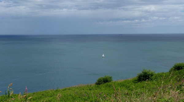
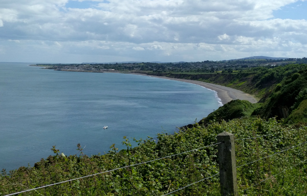
I pause for one look back over the bay,
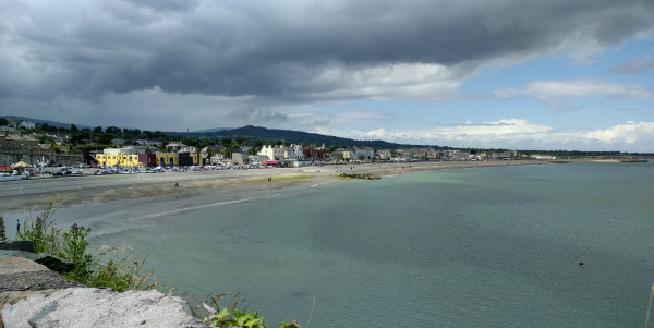
then set off for Greystones.
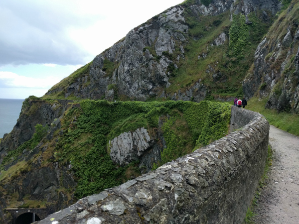
To my surprise, the Cliff Walk is smooth and broad, with gradual ascents and lots of room to pass hikers coming the other direction.
Just off to my left is the Irish Sea, a beautiful play of blues and greens as the sunlight reflects off the water.
Right below me are the rail lines that the DART and commuter trains use to run along the coast. Both the rail lines and the cliff path feel like narrow shelves carved in the side of a headland that would otherwise run straight down to the sea.
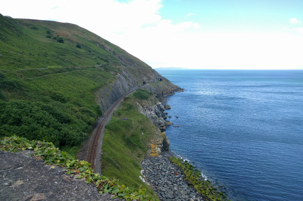
The next three hours are some of the best hours I’ve spent in Ireland to date. Every curve of the path brings a new view of the Irish Sea. There are seagulls and cormorants and other birds I can’t identify, all perched on rocky spires or soaring below me along the cliff faces.
An interpretive sign tells me that I’m passing over Brady Hole, a cave with ocean access that was the perfect smuggler’s den before the railroad filled it in to create a tunnel.
Another sign further on tells me that this charming pile of stone is the remains of Lord Meath’s Lodge.
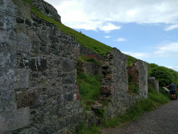
It’s an incredibly narrow building, and was used to charge the public a penny to access the rest of the pathway. Except on Fridays, of course, which Lord Meath reserved for his personal use.
From the signs at Lord Meath’s Lodge and later research, I learn that the path I’m walking is the access path for the railroad, built between 1847 and 1856. The easier pathway for the railroad would have been further inland, but Lord Meath didn’t want a railway cutting his estate in half and instead gave the coastal route to the railroad company free of charge. However, it was and remains one of the most costly stretches of railroad in Ireland, because of the number of tunnels required.
Near the halfway point the railroad disappears into a long tunnel and is no longer visible below me. The pathway is even higher up the headlands now, and the green of the hillside vegetation against the blue sea and black rocks is so vivid that I have to remind myself I’m actually seeing it instead of watching a movie or looking at a perfectly photo shopped picture.
It rains three times during my hike. Typical of Ireland, the rain never lasts long and is followed almost immediately by sunshine. I use my umbrella to keep the rain off my face, but the wind off the sea threatens to turn it inside out several times.
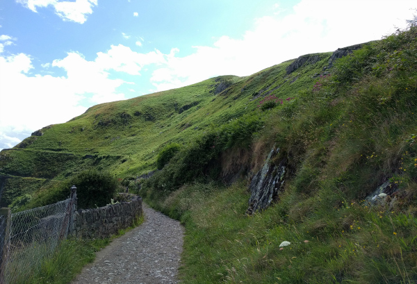
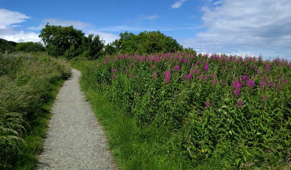
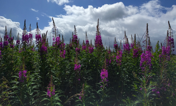
Finally, about two thirds of the way along the cliff path, I crest the last headland and begin a long, gentle descent into Greystones.
The path has cut inland, and instead of walking along the cliff face, I’m now walking through fields of wildflowers.
I round a corner, and there in front of me is a yellow building parked alongside the path.
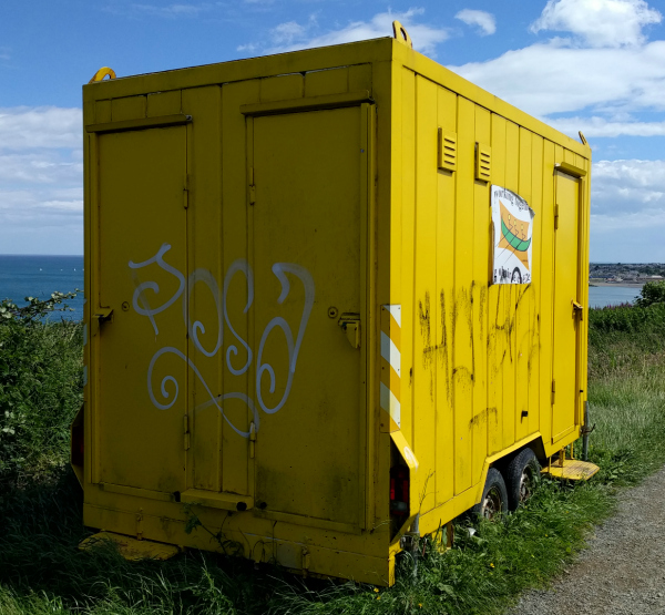
What is this shed doing here? How did it get here? What is it used for? There are no signs to answer these questions, just the incongruity of the modern world intruding on a pathway of natural beauty.
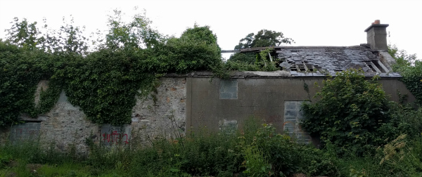
Even though the pathway is now gently sloping down, it takes a long time to come off the headland and into the valley. A signpost near a bend in the path tells me that I’m near the medieval village of Rathdown.
No sign of the village exists today, but there’s a picturesque ruined church nearby. Delighted, I cross the railroad tracks and follow a couple in front of me down a side street.
I pass Captain Tarrant’s house, draped in ivy and quite mysterious in the afternoon light.
Once round the corner, I’m at the edge of a small meadow. Nestled on the other side of the meadow is St. Crispin’s Church, looking even more photogenic than it did on the information board.
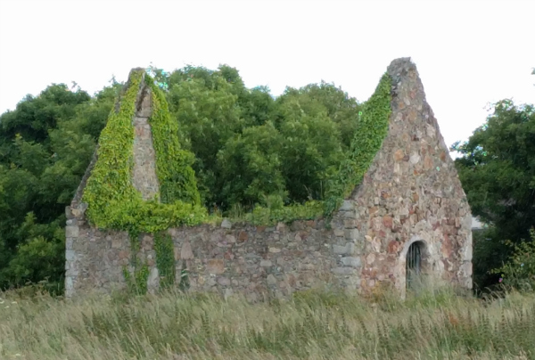
I follow the gravel path and step through waist-high grass to come right up to the church. Someone has planted flowers along the outside of the west wall: several rose bushes and other plants I don’t recognize.
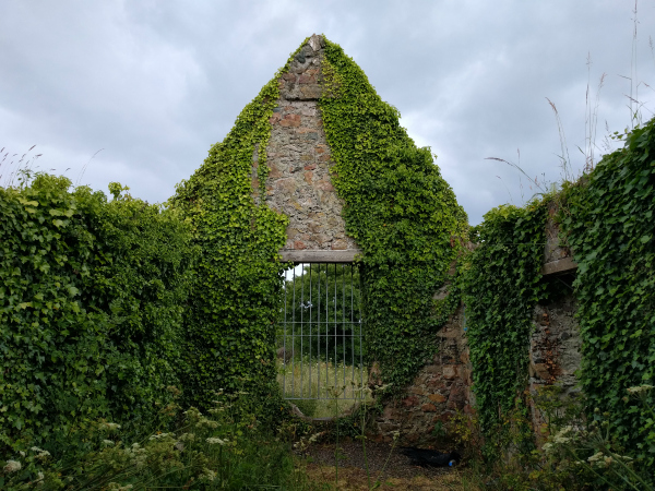
As I peer into through the gate over the entrance, I’m struck by how small it is – barely the size of a medium-sized bedroom. And yet there’s a feeling of history here, as if I could close my eyes and almost see the medieval villagers coming to worship on a Sunday morning. In a time when most people were outdoors as often as possible, coming into a man-made building like this must have been memorable.
I’m reluctant to leave St. Crispin’s, but I’m also eager to finish the Cliff Walk. I retrace my steps back to the pathway and continue on.
The Cliff Walk turns left sharply, and abruptly I’m back in civilization. Directly ahead of me is a bay stretching back towards the Cliff Walk. But it’s the construction fence and new housing development to my right that tells me I’m on the outskirts of Greystones.
I sit for a few minutes along the bay, then follow the Cliff Walk through an increasingly urban landscape. After fifteen minutes or so, the Cliff Path terminates at Greystones Harbor.
The concrete steps leading from the access road down to the harbor beach are too inviting to resist. Tired and footsore, I use my daypack as a pillow and stretch out in the sun for a late afternoon nap.
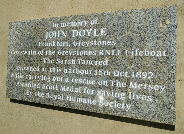
45 minutes later, I am refreshed and decide to explore the harbor. I pass this plaque as I begin my exploration of the harbor’s south pier.
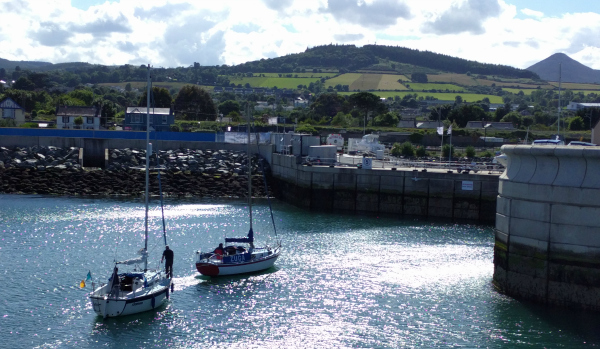
There’s a group of two-man sailing boats coming into the harbor, and I watch as they jump into the shallows and begin the long process of pulling their boats out of the water. Further along the harbor wall, men and boys are fishing off the ocean side.
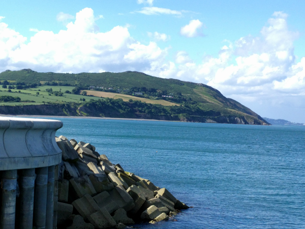
When I get to the tip of the harbor wall, there’s a great view north of the headland and fields I recently crossed on the Cliff Walk.
I bask in the afternoon sun for a while, watching boats come and go, and fellow tourists pose for pictures.
As I walk back along the harbor wall, two teenage boys strip to their swim trunks and dive off the wall into the harbor, despite the signs saying that diving is strictly prohibited. A third boy meets them coming up the slipway, towels in hand.
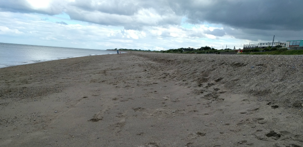
A quick check of Google maps shows me that the train station is further down the coast, near the southern end of Greystones. I follow the road out from the harbor and up a hill, and before me is a new beach, real sand this time and stretching south for quite a ways.
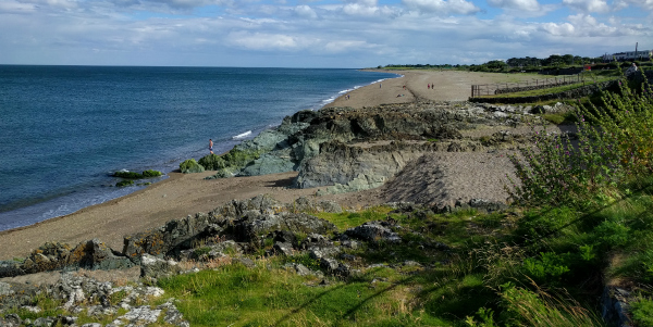
This is clearly the main public beach in Greystones. There are families and children running up and down the beach and walking along the hilltop pathway as well.
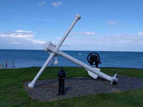
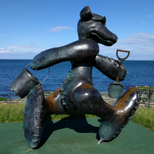
Not surprisingly, the public art along the sidewalk is of a decidedly nautical nature:
The sand is a bit rocky under my feet, but the coolness feels great after hours spent inside sweaty tennis shoes. Shoes and socks in hand, I roll up my pants to the knee and tentatively let the first wave wash over my feet.
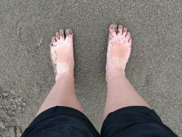
And boy is that water cold! It feels even better on my feet than the cool sand, though, and I let the waves wash over me for several minutes. Now that I’m on the beach, I can see a few people swimming in the water. I suppose if you’re local, you get used to the temperature.
I wander down the beach for a long time, following the curve of the tide line and people-watching. The beach seems to stretch on and on.
I pass couples walking hand in hand, and dogs happily chasing balls along the beach or into the sea. One family is kicking a soccer ball around. Another is collecting some interesting rocks from the high tide line. Further down the beach a group of adults are tossing a Frisbee back and forth.
Time passes as I find a spot to sit and let my feet dry. As it always does, the sound of the waves rippling onto shore puts me in an almost meditative state. I’m happy to simply sit and be, to not think but merely appreciate the sun on my face, the sand on my toes, and sight and smell of the sea in front of me.
Eventually I do make my way to the rail station. I use the 30 minute wait to explore a bit of the town of Greystones, then happily board my train for a ride back up the very coast I walked down several hours before.
Coming out of the train station at Killiney, I meet Patrick, a twenty-something professional violinist in town for a few days to play a gig in Dublin. We walk into town together, and I discover that Patrick is Irish but moved to Switzerland to study with a violin master. He’s spent most of his summer on airplanes to various concerts all over Europe. It sounds quite glamorous to me, but I can also tell that he’s tired of traveling. We part at the local pub, he to his hotel, and me into the pub for a long-awaiting evening meal.
The pub is noisy and crowded, but I find a small table to myself near the front. It isn’t long before I overhear the table kitty-corner to me discussing the recent Brexit vote. One of the four gentlemen catches my eye and pretty soon we’ve struck up a conversation.
The four men are having a going-away celebration for one of the middle-aged men. There are two in total, as well as the older Scotch-Irish gentleman and the younger one who’s close to my age. I talk with them on and off for the next couple of hours, mostly to the Scotch-Irish gentleman and a bit with the others.
Finally, full to the brim of beautiful nature, excellent company, and good food, I leave the pub and make my way home. Jeanne and Simon are both in the kitchen when I arrive, and I fill them in on my afternoon adventures.
When I finally climb into bed that night, I can hardly keep my eyes open. What an incredible day! From the serendipity of Jeanne’s offer to take me out to Powerscourt, to the estate itself, to my afternoon Cliff Walk, to meeting Patrick and the boys at the pub – it’s been a long day full of amazing experiences.
I fall asleep feeling incredibly lucky and blessed.
Up next: Goat Castle, the Irish Maritime Museum, and an evening sail around Dalkey Island


This was a lovely walk with you! Mum
Aww thanks Mum! 🙂
A day obviously full of activity — the primarily man-made environs of Powerscourt to the more natural Cliff Walk. I personally prefer the more natural landscape. Along the way, points to ponder — why was Rathdown initially populated, and why did it decline. I’d imagine something to do with serfdom, though it appears that the village was established after 1600…
Along the way, the Viscounts Powerscourt & the Earls of Meath. An interesting (and tiring) day…
Yes, it was an incredibly action-packed day. My feet were killing me when I got home! Totally worth it, though.
And yes, it is interesting to wonder what happened to Rathdown. Sometimes imagination is more pleasing than Googling an answer. 😉